
Brief justification
In order to develop effective measures for the protection and conservation of wildlife in the Arctic and Antarctica, regular studies of polar animals and their habitats are necessary. Manned aviation has long been used to study them, and now unmanned aerial vehicles (UAVs). But so far little is known about their numbers and condition. To carry out effective monitoring in harsh polar conditions, new technical means and methods of collecting materials based on UAVs, as well as modern computer methods of processing them, are needed.
Goal
Animal health monitoring and multi-species accounting from UAVs in polar regions.
Brief description of the project
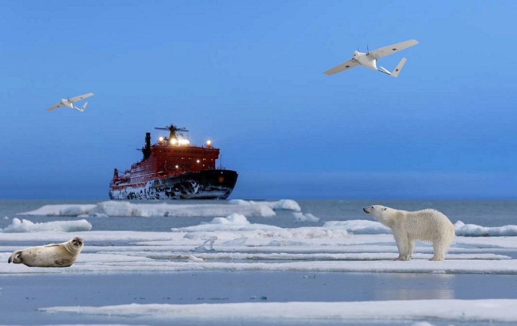
To study polar animals, several UAVs based on an icebreaker or shore are being photographed from aboard. Drones are equipped with cameras in various areas of the optical spectrum, including infrared and ultraviolet ranges, as well as navigation systems, altimeters and other equipment. The icebreaker provides forward motion, and the UAVs are shooting tacks mainly in the direction perpendicular to the movement of the icebreaker.
After preliminary on-board processing and compression, the collected materials from the UAV are promptly transferred to the express processing center on the icebreaker or shore to assess the quality of materials and further flight planning. Further, the information is transmitted to the coastal data processing and analysis center. To estimate the number of animals, extrapolation of sample data and estimates of the number of animals of various species are performed.
Collection of materials and data processing
Determining the area of work and choosing the time of aerial photography
The initial stage includes the definition of the area and the timing of aerial filming. To do this, it is necessary to take into account the size of the territory, the type of terrain and the density of distribution of animals. The choice of the optimal time for shooting depends on the life cycle of the animals. Shooting from a UAV should be carried out during such a period of animal activity when it is possible to perform the most complete accounting of them.
The choice of drones, routes and heights of aerial photography
The choice of drones depends on the job specification. There are UAVs for detailed shooting of small areas and larger aircraft to cover large areas. Flight routes are laid out in such a way as to obtain the most complete and uniform coverage of the area without large gaps. The altitude of the drone should provide both sufficient image resolution to detect animals and a wide area circumference for a representative sample. As a result, it allows you to get more accurate results when extrapolating data.
Methods of aerial photography of animals
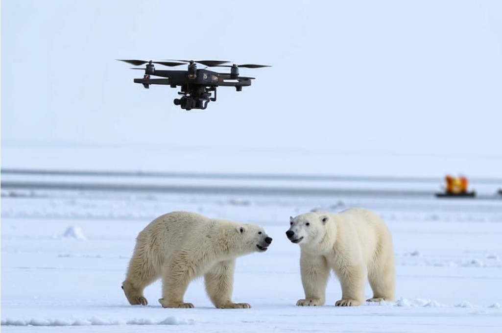
Methods are used both for the direct detection of animals and for the traces of their vital activity. In addition to conventional digital photography, infrared, ultraviolet and other types of photography are used in the visible range of the spectrum. The use of thermal imagers makes it possible to identify animals by thermal trace even in conditions of low visibility or dense vegetation, and the use of ultraviolet light allows you to detect masked individuals.
When accounting for UAVs, special requirements are imposed on the equipment: cameras must have high resolution, wide viewing angle and be stable under vibration, withstand harsh operating conditions. The angles of the shooting equipment must be metrologically calibrated. In addition to special equipment for controlling UAVs and aerial survey equipment, a navigation system, an accurate altimeter, and aircraft position sensors are needed.
Decryption of air photos
At the stage of decoding images from UAVs, specialists analyze the obtained materials, classifying the types of terrain and identify animals on ice, land or in water. Both manual methods and computer methods using machine vision and neural networks are used to detect and recognize animals.
Counting animals and correcting under-counting
Counting the number of animals in the images is carried out by directly counting the individuals in the images in manual or automatic mode. At the same time, the underestimation at the edges of the images is corrected using statistical models. The degree of underestimation is also assessed due to the complexity of the terrain and the peculiarities of animal behavior.
Extrapolation and interpretation of air accounting results
At the last stage, the accounting data are extrapolated to the entire territory surveyed by the UAV and estimates of the number of animals of different species are made. The results of the work are interpreted by biologists and geographers together with other specialists. The results of the work can then be used to assess the state of polar ecosystems, protect them, and develop strategies for biodiversity conservation.
Preparation for work
The implementation of the entire project requires thorough scientific and technical training in biological, environmental, geographical and other areas, as well as serious mathematical and organizational and technical support of the work. An integrated approach dictates combining the efforts of professionals of different profiles – from biologists to technical and IT specialists.
Among the priority areas are the following:
· “census” of animal species living in polar regions and characteristics of their habitat;
· development and improvement of methods and techniques of aerial photography and methods of collecting materials;
· improvement and automation of methods of processing materials and accounting of animals;
· improvement of extrapolation methods and algorithms for estimating the number of marine animals;
· improving the interpretation of the results of the aerial survey of animals in the polar regions.
By Nikolay Kuznetsov, n-kuz@yandex.ru January 2023

