Photo: Rosatom State Corporation
Choosing a hybrid scheme
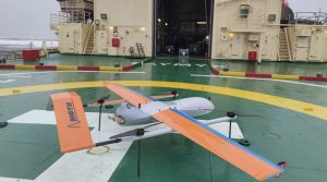
MIPT, together with the Directorate of the Northern Sea Route of the Rosatom State Corporation and Irbis Sky Tech LLC, successfully completed a flight test cycle of an operational ice reconnaissance complex based on an unmanned vertical takeoff and landing aircraft. The unique Russian system developed at MIPT, in addition to operational monitoring data, allows you to obtain a local three-day forecast of the ice situation in a given water area.
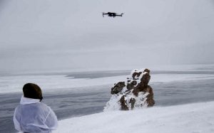
The device took off from the deck of the Yamal nuclear-powered vessel and collected operational information about the ice situation in the waters of the Ob Bay of the Kara Sea. During the flight, radar images were formed, video recording was conducted in the optical and infrared range. All terrain-specific data was transmitted to the operator on the ship. The specialists also tested the automated landing system on the deck without human intervention.
The development of the monitoring system has been carried out by MIPT specialists with the support of the NTI Foundation for more than five years. In the process, the concept of the solution, the type of media, and the composition of the equipment were repeatedly revised. As a result, the complex includes radar equipment, an optoelectronic system of visible and infrared ranges, a high-performance computer, an automatic landing system using real-time kinematics and machine vision. Special software has been developed for on-board operational processing, including the use of convolutional neural networks.
“Despite the fact that a number of operating foreign and promising domestic spacecraft receive ice monitoring data, the ship’s captain needs operational information, as they say, on the “short shoulder” in order to plan a route for the next few hours of travel.
We did not immediately settle on a hybrid aerodynamic drone, we started with a much heavier unmanned helicopter. However, after repeated flight tests, it was concluded that the payload carrier should be a tiltrotor aircraft performing takeoff and landing in copter mode, and en–route flight should be like a classic aircraft.
This combination, along with the possibility of safe landing on the deck of an icebreaker, allows you to achieve maximum flight reliability in difficult Arctic conditions, where it is impossible to navigate the geomagnetic field, and increased wind loads, dense clouds and rapid weather changes are not the exception, but the rule,” said the head of work on the creation of the complex, executive director of scientific and technical the Environmental Monitoring Center and ecologists of the Competence Center of the NTI MIPT Alexander Rodin.
The development team has developed the optimal format for the data received by the complex. According to Rodin, initially they sought to obtain the most detailed radar “picture”, but then it turned out that for a competent interpretation of the ice situation, detail is not as important as a wide capture band and accurate radiometric calibration.
Scientists had to discuss a lot of nuances, up to the color scheme of the representation of infrared images, with sailors who will use this information on a daily basis.
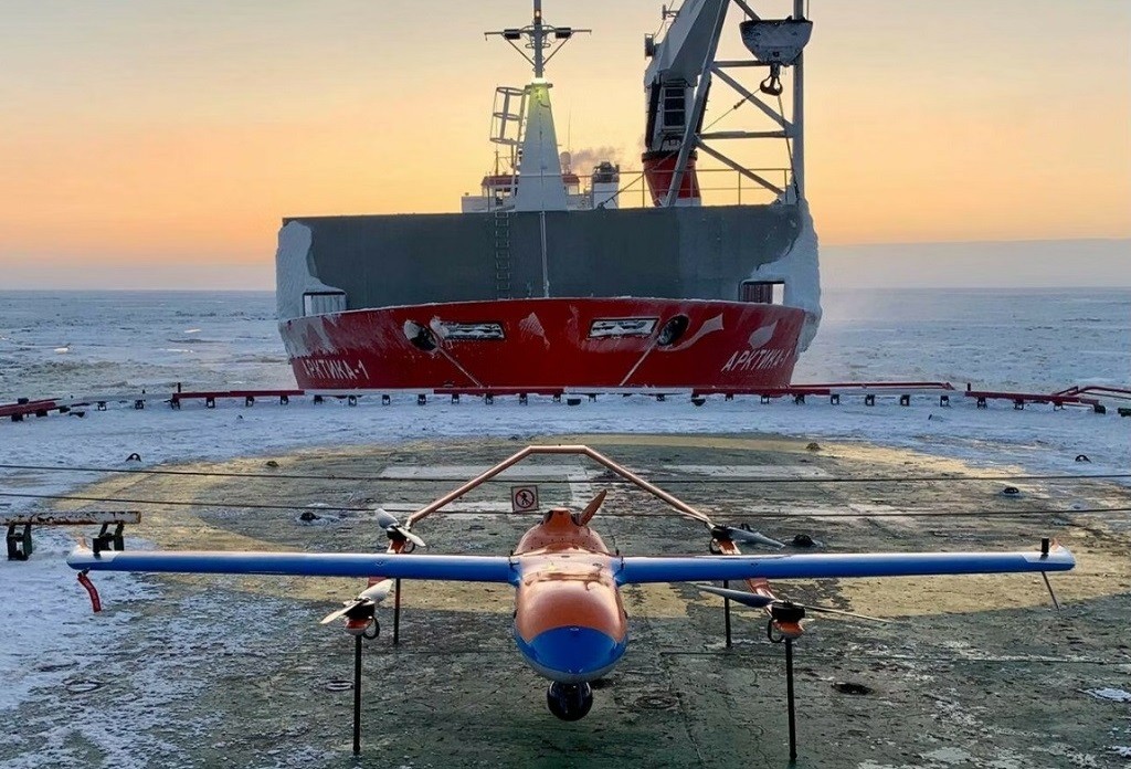
Final tests
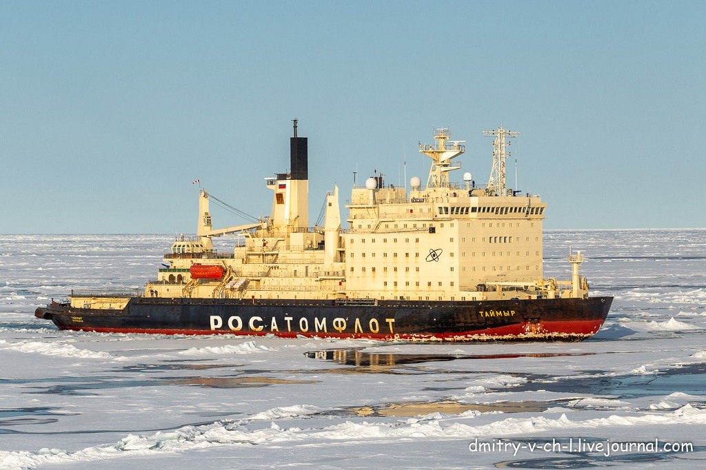
Photo: Icebreaker “Taimyr”
The final tests of the created device took place in the waters of the Gulf of Ob in difficult weather conditions during the polar night. According to the developers, wind gusts reached 20 m/s, the air temperature dropped to -30 °C, and the aircraft itself repeatedly fell into areas of severe icing. Takeoff and landing were performed automatically from the deck of the nuclear icebreaker Yamal, which was both in a drifting state and on the move during the convoy of ships.
Despite the difficult conditions, a series of flights were performed and images of the sea surface with various types of ice formations were obtained in the visible, infrared and radar ranges in real time. In addition to operational information, the icebreaker crew was provided with data on the forecast of the ice situation.
The forecast was obtained using a predictive model developed at MIPT based on detailed calculations of sea currents, meteorological phenomena and thermomechanics of sea ice. The results obtained fully confirmed the correctness of the chosen concept of operational ice exploration for its implementation into the daily work of the nuclear icebreaker fleet.
Employees of the Advanced Engineering School of Radar, Radio Navigation and Software Engineering at MIPT play a key role in the development of the Arctic UAV radar station.
“One of the important projects of the FIR is the creation of an ice reconnaissance radar for light UAVS. The solution being developed is based on small-sized radar equipment that provides polarimetric radar data, and a digital radar data processing system that provides continuous formation of a radar image along the line of movement of the carrier with a frame width of up to 10 km in soft real time.
As part of the tests carried out, the main parameters of the radar operation were confirmed, the correctness of the algorithms and data processing software was confirmed, proposals were developed to improve the developed solutions to increase the stability of operation in difficult flight conditions of the carrier.
The task of the MIPT PISH FIR is to create a convenient and reliable tool for conducting operational monitoring of the ice situation, which in the future could be equipped with both the icebreaking fleet and individual coastal points to ensure ice exploration of the busiest sections of the NSR,” Kirill Bukharov, Deputy Director of the PISH FIR for Scientific work, added.
MPTI