Prospects for the development of unmanned aircraft
Currently, there is increasing interest in unmanned aviation technologies for monitoring facilities in the Arctic. They allow you to obtain data on the underlying surface over areas over which it is impossible to obtain data due to clouds from space, or where high-precision data is required.
The strategy for the development of unmanned aircraft of the Russian Federation (RF) until 2030 and for the future until 2035 has been adopted, which aims to bring the volume of the Russian market of unmanned aircraft systems (UAS) will reach 1 million units by 2030.
The strategy, which emphasizes the prospects for the development of unmanned aircraft, contains the following main sections:
· I. The main provisions.
· II. Characteristics of the unmanned aviation industry in the RF and the world.
· III. Goals, objectives, priorities and target indicators of implementation.
· IV. Development scenarios.
· V. Approaches to implementation.
· VI. Resource provision and sources of financing.
· VII. Monitoring, control and management of the implementation.
Despite the claimed high sales figures of UAVs, the field of unmanned aviation in Russia faces legal, regulatory, organizational, and technical barriers. Restrictions on unmanned flights were introduced in 70 regions, but most of the airspace of the Arctic zone of the Russian Federation (AZRF) remained available for unmanned flights.
The Arctic and the Far East, as well as the marine areas of the waters of the exclusive economic zones, need constant monitoring from the air, cargo delivery by air transport, and emergency response, while these regions are characterized by low air traffic intensity, which creates conditions for the use of unmanned aircraft.
Due to the decrease in the Arctic seas, new opportunities for maritime navigation along the Northern Sea Route (NSR) are emerging. And due to the increase in air and water temperatures, conditions for human activity and life are improving.
When planning aviation operations using unmanned aerial systems (UAS) in the Arctic, it is necessary to take into account the specifics of the region: harsh climate, polar night conditions, sparsely populated territories, logistics difficulties, lack of ground and connected infrastructure, as well as environmental risks.
At the same time, the airspace in the Russian Arctic is not loaded with heavy traffic, which potentially makes it possible to allocate permanent unmanned corridors.
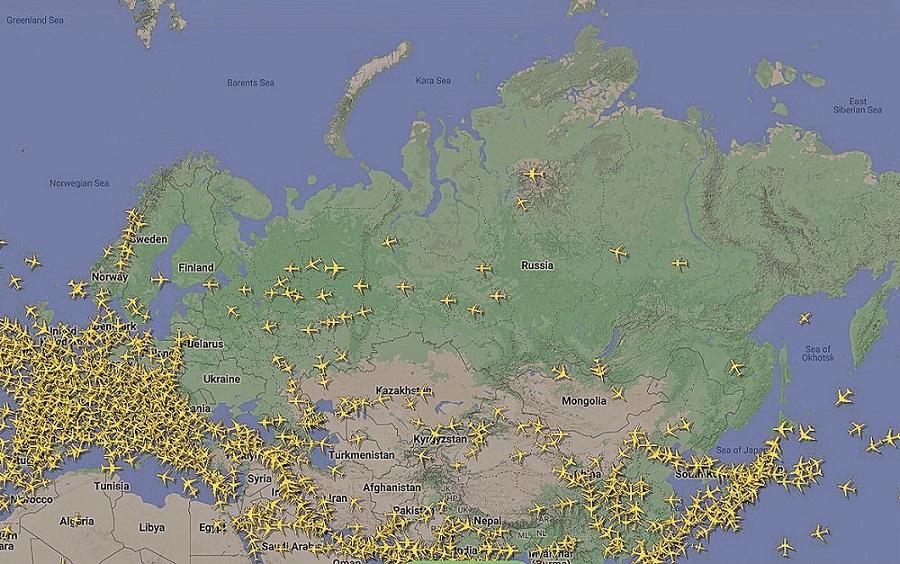
Air traffic map on one of the days of 2023
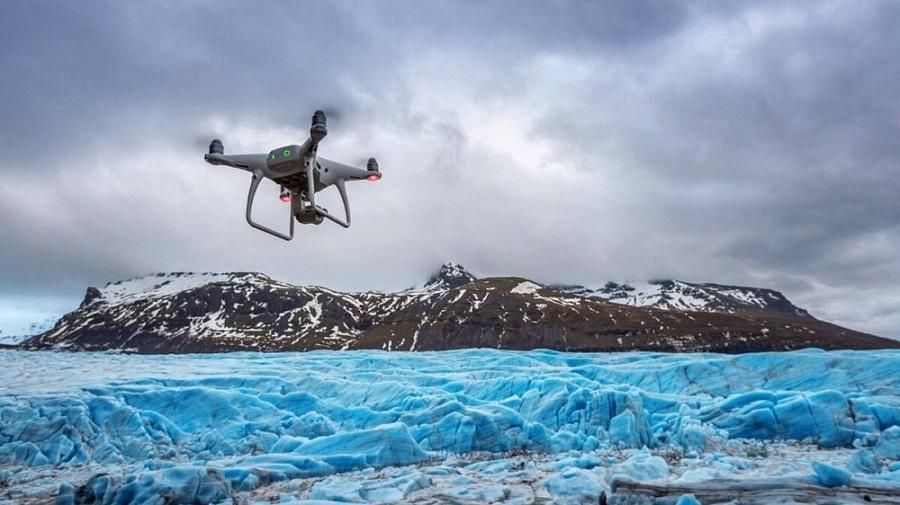
Monitoring of ice conditions and snow cover
Monitoring involves regular receipt of information to be able to compare the actual situation with the initial one, which will allow you to make the right decisions taking into account the dynamics of changes. Satellite imagery data is needed in cases where it is necessary to obtain results over large areas, while ultra-high accuracy is not required.
Monitoring of the northern territories, including the waters of the NSR and port infrastructure, can be divided into two main types of work:
· patrolling of the water area, which is carried out regularly;
· shooting of adjacent areas when performing related work.
One of the most popular types of UAV applications in the Arctic seas, primarily along the NSR route, as well as near offshore platforms under construction and in operation, is ice monitoring.
The total amount of financing for the NSR development plan passing through the Russian Arctic may amount to about 2 trillion rubles by 2035, and private investors will invest about 15.6 trillion rubles in the development of investment projects.
In order to minimize threats during navigation, it is advisable to conduct background monitoring and build survey ice maps using data obtained from the UAV. Drifting ice and icebergs pose a threat to navigation and the operation of offshore structures.
In the process of ice exploration, the following are performed:
— ice monitoring. Climate warming, changes in the Arctic ice cover, and the development of oil and gas fields contribute to an increase in traffic volumes through the NSR;
— ice control. It is important to ensure timely detection of potential hazards, determine the parameters of ice fields, identify large ice channels, hummocks, cracks, faults, fields, polynyas, and assess their degradation.
Comprehensive monitoring includes tools not only for unmanned aircraft, but also for remote sensing from satellites and ground monitoring.
The tasks of UAS and barriers of operators
There are quite a lot of tasks performed using BAS in the Russian Arctic, for example:
· cadastral works, geodesy and cartography;
· Construction monitoring;
· monitoring of power lines;
· Geophysical work;
· Vehicle monitoring;
· monitoring of riverbeds and flood zones;
· Environmental monitoring;
· air cargo transportation;
· monitoring of infrastructure facilities;
· security, safety, etc.
Thus, it becomes a priority to provide an up-to-date and up-to-date cartographic and geodetic basis for the effective solution of strategic tasks of the socio-economic development of the Russian Arctic based on the results of monitoring.
The Arctic, like outer space, does not forgive mistakes. In a harsh climate and a fragile natural ecosystem, each man-made accident raises many questions. As a rule, environmental disasters occur where the pace of scientific provision is inferior to the speed of development.
The main technical barriers to the use of UAS in the Arctic are related:
· with restrictions on the duration of the flight of domestic UAVs;
· due to the lack of widely available satellite communication technologies;
· lack of infrastructure for the operation of various UAVs;
· the lack of standard BASS models for year-round operation.
It is necessary to overcome technical and regulatory barriers to achieve strategic goals for the development of unmanned aircraft in the Arctic, taking into account regional specifics. To achieve this goal, modernization of approaches to managing the development of unmanned aircraft in the Russian Arctic will be required.
Zaletskiy A.V.

