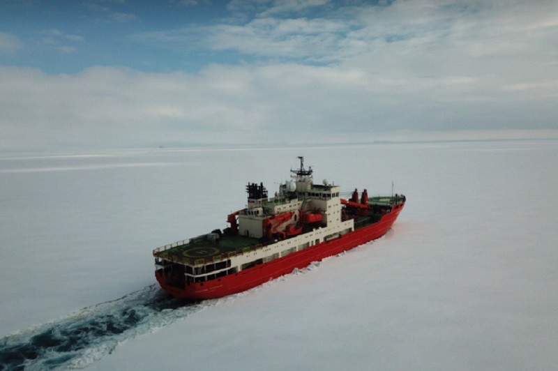
The vessel Akademik Treshnikov
In 2022, the Russian Antarctic Expedition (RAE) conducted aerial photography of glaciers and studied the albedo (degree of radiation reflection) of various types of snow and ice surfaces. The Russian company Geoscan acted as a technological partner of the work: three types of unmanned aerial vehicles (UAVs) of their production rose into the sky over Antarctica.
The expedition started in early December 2021. The RAE participants were traveling on the research vessel Akademik Treshnikov on the route St. Petersburg – Bremerhaven – Cape Town — Antarctica.
On January 15, 2022, the ship reached Antarctica. The first place of work was the Molodezhnaya field base. There, in a few hours, the team had to shoot an area of several tens of square kilometers. Geoscan 701, an aerial photography complex (AFS) capable of being in the air for up to 10 hours, successfully coped with this task.
That day the weather was clear and cloudless, the wind was south-southwesterly, 2 m/s, the temperature at the shooting height was about -5 °C – ideal conditions for AFS.
The nearest area free of snow and ice was chosen as the starting position. After an hour of assembly and setup, the drone soared into the Antarctic sky. Radio communication and telemetry transmission were maintained using a modem installed on the roof of a nearby building.
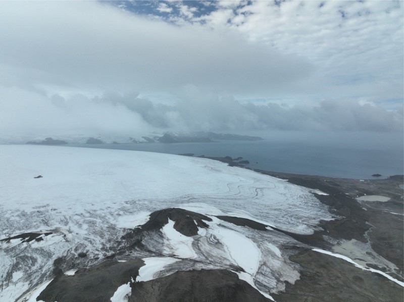
Bellingshausen Glacier Dome
The UAV flew smoothly and then landed safely near the take-off point. In 330 minutes, he took 1980 photos and filmed the territory between the Molodezhnaya and Vechernaya Mountain field bases, including the bases themselves and the nearest islands (total area — 80 km2). The resolution of the images was 9 cm/pixels, and the overlap was 70% (longitudinal) and 50% (transverse).
After photogrammetric processing of the materials, an orthophotoplan with a resolution of ~10 cm and a digital surface model with a resolution of ~25 cm will be obtained. They will be able to track the appearance of cracks in the Antarctic ice sheet, the dynamics of glacial covers and outcrops of bedrock in the coastal regions of the continent.
The next point of the expedition was the Bellingshausen station, which took seven days to reach. It is located on King George Island (Waterloo), located at the northern tip of the Antarctic Peninsula, between Drake Strait and Bransfield. Glaciers occupy most of the island, and only the southern part of it is freed from snow in the short Antarctic summer.
Work on the Bellingshausen began on January 25 and lasted about a month, however, due to bad weather (mostly due to fogs), flights were not carried out as often as we would like. The situation was also greatly complicated by the fact that the station is located exactly under the glide path of the Chilean airfield with a fairly dense traffic.
The UAV surveyed 75 km2 of the Fildes Peninsula with adjacent coastal cliffs. The shooting resolution was 4.5 cm/pixels. The Starisbury Peninsula was also filmed. Nelson).
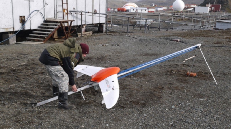
Bellingshausen station: The UAV is at the starting position. Photo: © I.V. Florinsky
The Type 201 model is an airplane—type drone designed for shooting large areas (from 15 to 42 km2, depending on resolution). His tasks included performing primary flights for further compilation of digital terrain models (DEM) of glaciers.
After the construction of the DEM, the UAV 401 model — a quadcopter capable of operating in a confined space and accurately skirting the terrain – was connected to work. An albedo detection device developed in the Arctic and Antarctic Research Institutes acted as a payload for the UAV.
The Bellingshausen and Collins glaciers were examined using this two-stage method. In two flights, the UAV performed AFS of the Bellingshausen glacier dome and adjacent territories with an area of 18 km2. The data obtained made it possible to build a DEM of the glacier.
The Collins Glacier had an area of 12 km2. The AFS and the survey of the territory were carried out. Six flights were performed at altitudes of 50, 75 and 100 meters. The obtained albedo measurement results will be used to monitor climate change.
On February 22, after completing all the work, the RAE team returned to Akademik Treshnikov. After traveling thousands of miles, the ship arrived at the port of St. Petersburg on April 12. The field stage is over, the desk stage has come — the analysis of the received materials.
The cooperation between AANIA and Geoscan has become a unique project in which, thanks to unmanned technologies, inaccessible areas of Antarctica have been explored.

