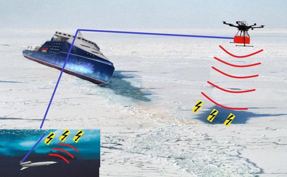
Ice exploration scheme
Aerial reconnaissance
The advantages of introducing drones for ice exploration on the Northern Sea Route (NSR) are considered, since the study and development of the Arctic is one of Russia’s priorities. Unmanned aerial vehicles (UAVs) and neural networks will determine the safe passage of ships. This will increase the accuracy of the assessment of the meteorological and navigation situation.
Ice reconnaissance is instrumental and visual observation of the ice situation. Ice conditions – the state of the ice cover on seas and inland waterways (rivers, lakes, reservoirs), affecting the conditions and safety of navigation of ships.
There are several methods of ice exploration:
- coastal and with the help of buoys;
- aviation (air);
- space (satellite).
Traditional coastal exploration is very expensive and can be used in straits or other bottlenecks. Ice exploration using satellite systems has limited accuracy, and when ice melts, a large error occurs, especially with high-frequency sensing.
Currently, aerial ice reconnaissance is performed using several types of ice surveys, while using:
- GPR shooting;
- aerial photography.
At the same time, it is now effective to use convertoplan-type UAVs to monitor marine areas from ships.
Ice reconnaissance devices
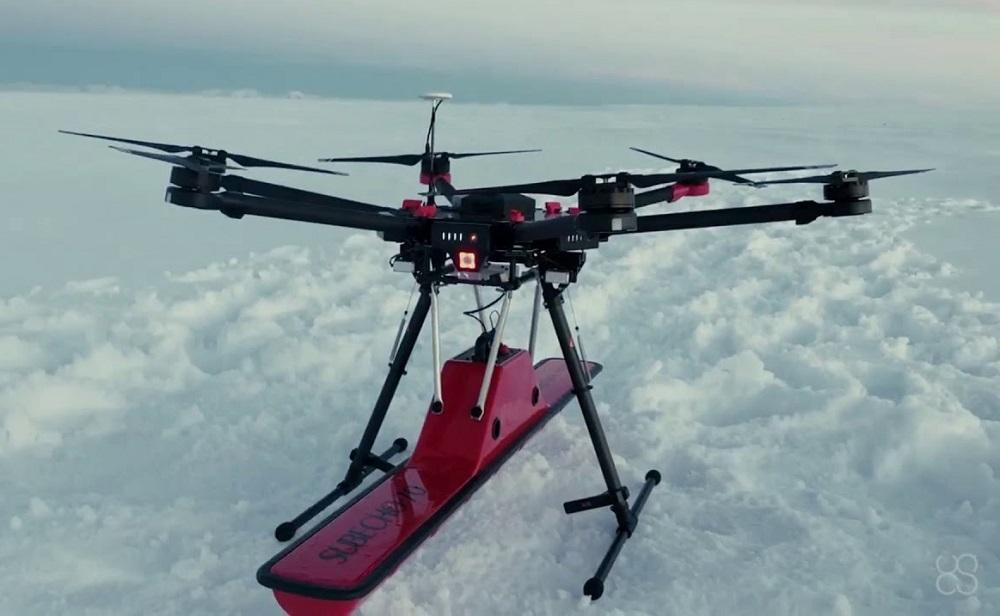
UAVs with GPR
GPR – a radar sensing device, is used for remote sensing of the ice cover. Its advantages of using with UAVs are as follows:
· fast deployability;
· the ability to take off/land from a limited area;
· compact and light weight of the complex;
· high shooting accuracy;
· flying at one altitude over the terrain;
· high performance;
· real-time data transmission capability;
· zero risk to personnel;
· cost-effectiveness in comparison with manned aviation.
Aerial photography from UAVs is also actively used in the development of the NSR. If an iceberg or a powerful ice formation is detected, it is possible to form a 3D model of it, calculate its dimensions, and assess the threat to marine infrastructure facilities.
The use of several UAVs from an icebreaker will allow you to lay the most optimal ice route for an entire caravan of ships. The efficiency of the data and their transmission to the control station will make it possible to optimize the movement along the route.
Information coming from various types of drones (aerial, underwater, ice) can be processed by the icebreaker’s control system and used to lay the most profitable routes.
Based on the above, it can be concluded that the use of UAVs in
ice exploration is more promising than conservative exploration methods due to their above-mentioned advantages.
The costs of developing ice exploration systems will be justified with the development of cargo transportation along the NSR and an increase in the volume of mining on the shelf in the Arctic Ocean basin.
Bibikov M.Yu., V.A. Nikitin V.A. , Smirnov V.V.
Source: International Journal of Humanities and Natural Sciences, vol. 5-1 (80), 2023, pp. 43-49.

